

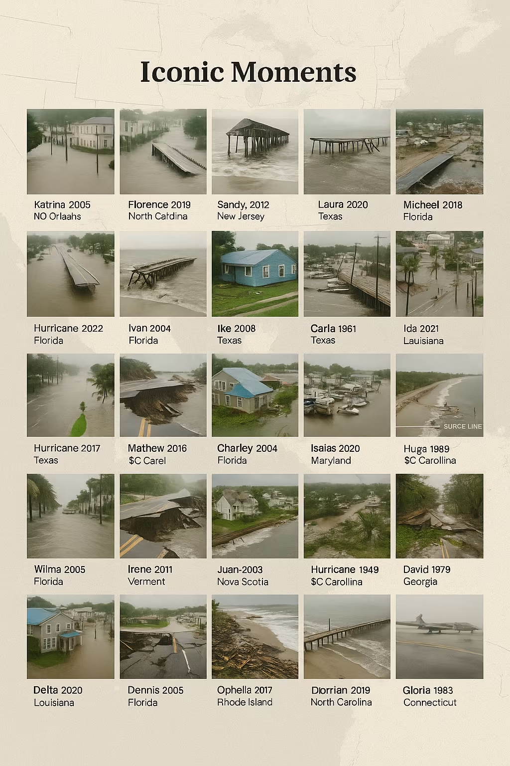
From the 1900 Galveston tragedy to the modern era of rapid intensification, America’s worst hurricanes are etched into archives as stark reminders of wind, water, and loss. These 26 photo descriptions capture moments that defined communities, reshaped coasts, and changed how we prepare for storms.
1) Galveston, 1900 — Ruins on the Strand
A sepia-toned street vanishes beneath splintered lumber and toppled homes, survivors clambering across wreckage. The nation’s deadliest natural disaster is frozen in a single frame of silence and ruin.
2) Great Miami, 1926 — Biscayne Boulevard Afloat
Downtown storefronts half-submerged; a Model T noses through brackish water while residents watch from second stories. The boomtown glow fades under a brown tide.
3) Labor Day, 1935 — Rails Twisted in the Keys
A black-and-white image of mangled railway tracks curling like ribbon along the Overseas Highway. Wind and surge turned engineering triumph into scrap.
4) Hazel, 1954 — Carolina Pines Snapped
The camera takes in endless rows of broken trunks, power lines tangled in needles. A quiet neighborhood wears the look of a lumber camp after a hard cut.
5) Audrey, 1957 — Water to the Windowsills
Cameramen on small boats film southwest Louisiana homes marooned to their eaves. Porch swings float beside kitchen chairs—domestic life set adrift.
6) Donna, 1960 — Shutters and Sails in the Keys
Bright paint and Cuban tiles glare under storm-clear skies as residents sweep glass from porches. A fishing skiff sits absurdly in a living room doorway.
7) Betsy, 1965 — New Orleans in the Dark
French Quarter balconies hold lanterns; the photo’s grain reveals a city without power. Floodlines mark stucco walls like rings in a tree.
8) Camille, 1969 — Slab Where a Home Once Stood
On Mississippi’s coast, a family poses beside a concrete foundation, eyes red and hollow. A single china teacup rests on the lip of the slab, unbroken.
9) Agnes, 1972 — Pennsylvania Under Brown Water
Aerial film shows the Susquehanna spread like an inland sea. Boxcars and rooftops dot the surface, an industrial archipelago adrift in flood.
10) Frederic, 1979 — Mobile’s Wharf Torn Open
Angle-iron and pilings jut from the bay; a shrimp boat leans on its side like a grounded whale. Dockworkers stare, hands on hips, counting losses.
11) Alicia, 1983 — Skyscrapers Scored
Houston’s glass towers reflect a lattice of taped Xs. At street level, traffic lights spin on snapped cables, pointing nowhere.
12) Hugo, 1989 — Folly Beach Pier Snapped
Photographers frame the pier’s broken spine against the Atlantic’s churn. A beach house, cracked open, shows a child’s bedroom to the sea.
13) Andrew, 1992 — Homestead’s Bones
A subdivision reduced to frames: two-by-fours, roof trusses, and bare slabs. A refrigerator stands in a field, door hanging ajar like a stunned mouth.
14) Floyd, 1999 — North Carolina Hog Farms Flooded
A helicopter shot reveals ponds of pink water washing across fields. The lens lingers on a highway sign peeking through the spread.
15) Isabel, 2003 — Chesapeake Bay Surges
Annapolis harbor swallows brick sidewalks. In one picture, a sailor wades thigh-deep, cradling a varnished tiller like a violin.
16) Katrina, 2005 — The Superdome’s Long Night
Inside, a wide shot shows thousands under the greenish glow of emergency lights. Outside, another frame catches rooftops surrounded by oily flood, spray-painted pleas for rescue.
17) Rita, 2005 — Gridlock to the Horizon
Aerial photos of I-45 show white and red lines to infinity. Beneath the steel heat shimmer, families nap on hoods and share meltwater from coolers.
18) Wilma, 2005 — Glassless Miami
Blue tarps checkerboard high-rises; reflective facades become empty sockets. Palms lie like felled spears along Biscayne Bay.
19) Ike, 2008 — Bolivar Peninsula’s Lone House
A famous frame: one stilt house standing amid flat, sand-scraped emptiness. In the distance, debris makes a new shoreline.
20) Sandy, 2012 — Subways and Sea
A camera peers down a Manhattan staircase into black water. Elsewhere, the Jersey Shore boardwalk twists like a ribbon pulled too tight.
21) Harvey, 2017 — The Boat Parade on I-10
Bass boats and airboats glide over interstate lanes. Volunteers haul toddlers and terriers into the bow, smiles thin but determined.
22) Irma, 2017 — Keys Boats in Parking Lots
A marina’s fleet lies scattered across asphalt, hulls beached against palm islands. The photo’s long exposure catches stars above a changed map.
23) Maria, 2017 — Blue-Tarp Puerto Rico
Hillsides dotted in cerulean rectangles; a drone frame shows switchback roads severed by landslides. A hospital glows on generator power, a solitary beacon.
24) Michael, 2018 — Mexico Beach Without Color
The Gulf glitters; inland, everything is beige—sand, sawdust, broken drywall. One photo’s only color: a red cooler and a child’s plastic chair.
25) Ida, 2021 — Waterfalls in the Subway
Cellphone footage becomes news: torrents cascade through turnstiles in the Bronx. Another shot captures cars bobbing in a Queens underpass like ice cubes.
26) Ian, 2022 — Sanibel Causeway Gone
Aerials show breaks where road met water; homes lean at angles that defy geometry. A mailbox stands, flag lifted, waiting for news that won’t come.
What These Photos Teach Us
Wind is spectacle; water is destiny. Again and again, the most devastating frames are not of shredded roofs but of storm surge and inland flood—oceans in living rooms, rivers on freeways, subways as waterfalls.
Infrastructure is memory. Piers, causeways, levees, substations—every failure is photographed, analyzed, and redesigns follow. Building codes and flood maps evolve because images made risk undeniable.
Preparedness saves the frame you never see. Elevated homes, surge-resistant windows, managed retreat, and early evacuation erase disasters from the film roll. Success in emergency management is photographic absence.
Climate context matters. Warmer oceans and higher baseline seas supercharge rainfall and surge. The recent gallery—Harvey, Ida, Ian—looks wetter, slower to drain, harder to insure.
How to Use a Photo Gallery Responsibly
If you’re assembling an actual photo feature:
- Caption precisely: include storm name, Saffir–Simpson category at landfall, location, date, and the photographer or source.
- Balance scope: mix ground-level human moments with aerial context to show both experience and scale.
- Offer resources: pair images with links to evacuation routes, FEMA assistance, and local hazard maps.
- Respect dignity: avoid exploiting grief; choose images that inform, not sensationalize.
These 26 scenes do more than document catastrophe—they chart a national learning curve. Every rebuilt pier, higher code elevation, and smarter evacuation is a footnote to the photo that made change unavoidable. As coastal populations grow and seas rise, the most important hurricane image may be the one taken before landfall: a family car packed, a shutter latched, a community ready.